Cache Report: The Scars That Heal

These trails are on utility-owned land and open to the public. The river runs on one side, with wetlands and farm lands on the other. Each little trail was only about 1 to 2 miles long, since the area is broken up with private parcels.
Trip Report

Cache #1: Our first cache was actually grabbed on some conservation land as we headed out of town. I solved the puzzle for it last week, so we decided to grab it today since we need it for a geotour. It was a half mile walk, so not quite a park and grab. Mo made the grab, then I noticed the gopher snake sleeping beneath the cache! We replaced a few feet away from the sleeping snake, and I notified the CO about the reason why we didn't do an exact replacement.


Cache #3: We planned a loop, walking the 1 mile to the furthest out cache then catching the other closer in catches on the way back. The fire scars weren't immediately obvious on this part of the walk, as the balsamroots and other flowers completely hid the worst damage. The logging and cleanup scars were a bit more visible, though, and the woods were oddly quiet. Fortunately, this cache gave us a beautiful view of the river, making it a good place for a bug drop.

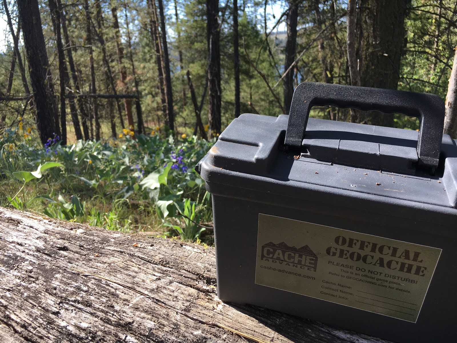
Cache #4: We retraced our steps a short way then jumped on a game trail. This took us to a lovely ammo can, where Mo was able to trade for a commemorative coin. This cache was positioned near the perfect resting log, so we enjoyed the river views for a bit before continuing on.
Cache #5: We had to head cross country for this cache, as no trails remained. This was through some of the worst of the fire damage. We could roughly follow some of the deep ruts left by the cleanup trucks, but my heart was heavy seeing the woods so torn up. After traversing a steep valley, we found the cache. It was a quick jaunt from here back to the car.

Cache #6: By now it was HOT. The next trailhead looked disappointing -- a 1 mile loop for four micros in the woods. No thank you. We stopped for the trailhead cache -- a micro hidden in a stick -- mainly because it afforded us nice views of two osprey nests. We even got to watch the eagles flying in to both nests. I forgive micros for two reasons -- if they are clever or if they bring me to something worth seeing. This one definitely fit the second requirement!

Cache #7: Our last stop was a short 1/2 mile long trail that lead to an overlook and a walk-in campsite. The cache was a small decon container and well maintained. It took us to another beautiful view of the river and what was once likely a nice view of a creek valley, but the fire scars in the valley were too fresh and exposed. Fortunately, it was also a short walk from a perfectly placed flat topped rock with a view over the river but no view of the fire scars. This made the perfect lunch time stop!
Wrap-Up

We might not have come on this journey if we had been aware of the fire scars and how broken up the trails were. That being said, we still had a great time and discovered new views of a stretch of the river we had only previously viewed by car on the opposite bank!

Comments
Post a Comment